
Maps
Your festival site, on a map in your app
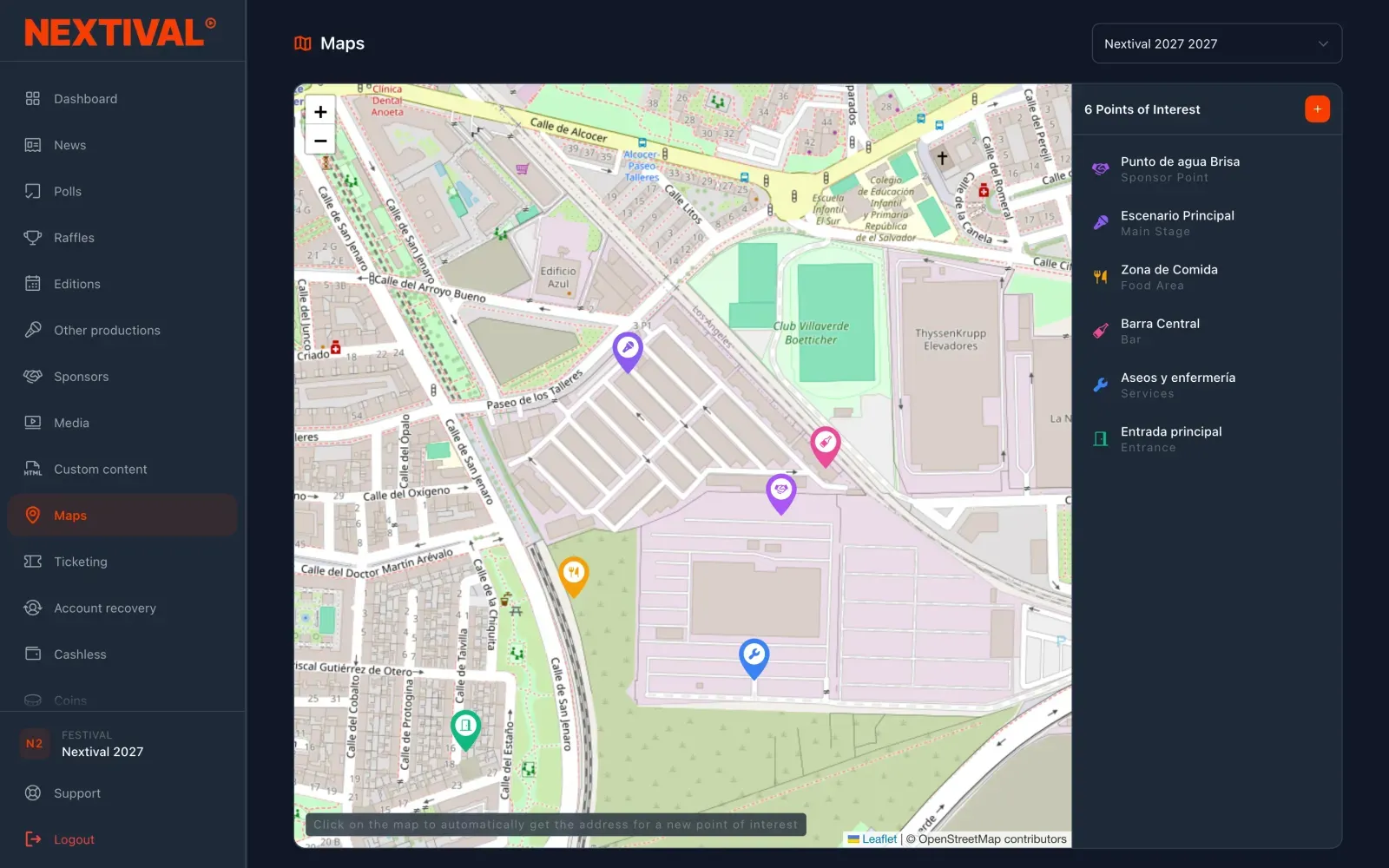
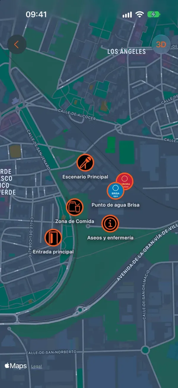
You place the stages, bars, toilets and entrances on the map. Your audience sees them in the app, taps one to find out what it is and opens directions in their phone’s maps app.
A site plan in an image answers nobody’s questions
The plan nobody can read.
An image of the site on social media, impossible to zoom on a phone and out of date as soon as a bar moves.
The same questions, over and over.
Where are the toilets, where can I eat, which way is the entrance. Your team answers them all day long.
The brand nobody sees.
The sponsor of the water point doesn’t appear anywhere your audience is actually looking.
How does it work?
Place the points.
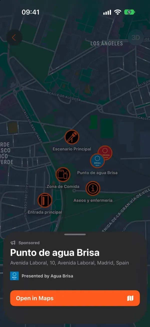
Click on the map or search for the address. Each point gets a title, a category and, if you like, the brand of one of your sponsors.
Get started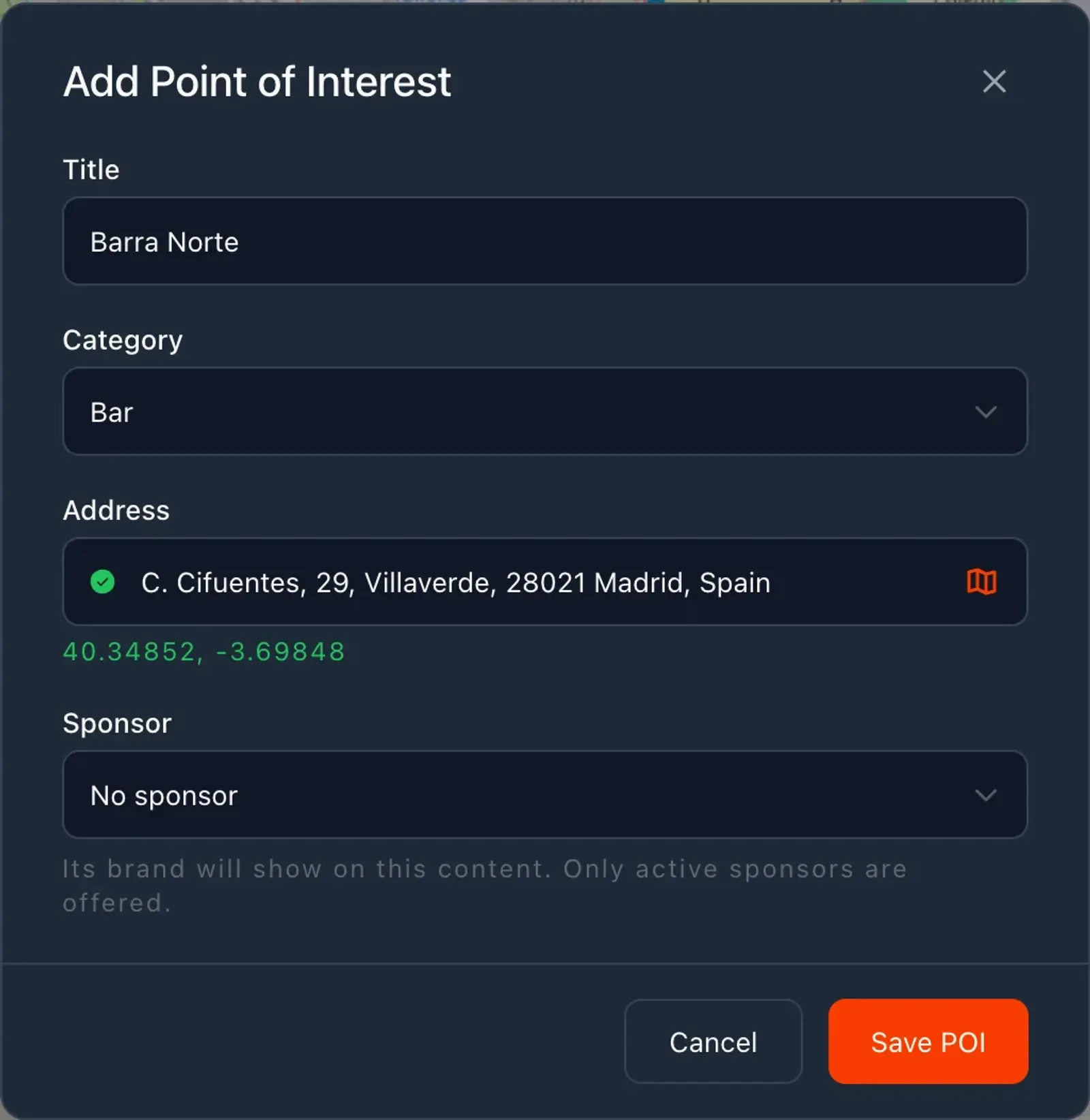
Your audience adds the map.
The map lives in a widget on the app’s Home tab. Each attendee adds it with the + button and has it one tap away.
I want to try it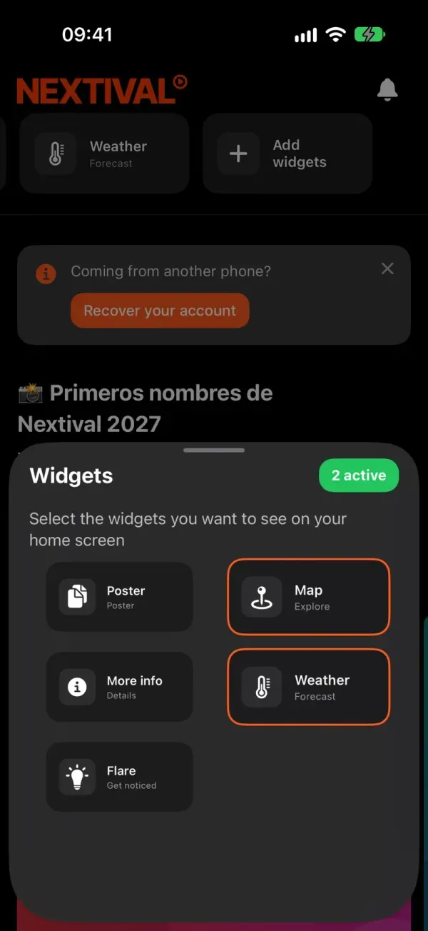
They find every spot.
Tapping a point opens its card with the category and address, and “Open in Maps” gives them directions in their phone’s maps app.
Get started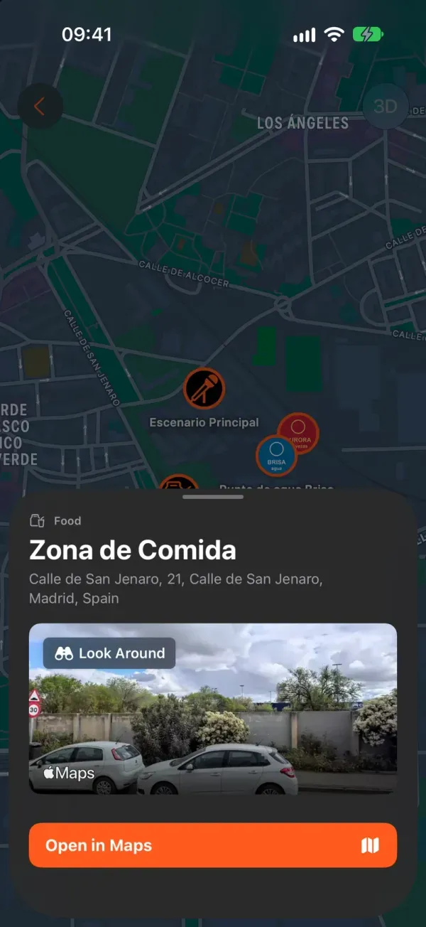
One map per edition, and the app always shows the current edition’s map: your audience doesn’t have to choose anything.
Capabilities
Categories with their own icon
Main stage, bar, restaurant, food area, facilities, entrance, parking, hotel, hostel, campsite, bus and taxi stops, and generic or sponsored point.
Address suggestions
Type the address and pick a suggestion, or place the point with a click. If the spot has no address, fine-tune it on the map.
Branded points
The sponsor’s logo on the marker and their credit on the point’s card.
A card for every point
Category, name and address. On iPhone, also a street preview where one is available.
Directions in the phone’s maps app
“Open in Maps” takes the attendee to the point with their phone’s maps app: Apple Maps or Google Maps.
One map per edition
Each edition has its own, and you edit, move or delete points one by one when the site changes.
Frequently asked questions
No. The map doesn’t ask for location permission or draw routes inside the app: to get to a point, attendees open it in their phone’s maps app.
No, there is one map per edition. If something changes from one day to the next, say so in the point’s name, for example “North Bar (Saturday only)”.
In the Map widget on the app’s Home tab, which each attendee adds with the + button. Your festival needs that widget switched on; the Nextival team does that.
Yes. When you save a point in the CMS, attendees see it as soon as they open the map again.
Put your festival site on every attendee’s phone
Managed from the CMS, live in your white-label app
Every Nextival module is set up in the same dashboard and shows up in the same app. Nextival switches on the ones your festival needs.
- Festival CMSThe web dashboard where your team prepares the festival.
- White-label appYour festival’s own app on iOS and Android, under your name.
More modules